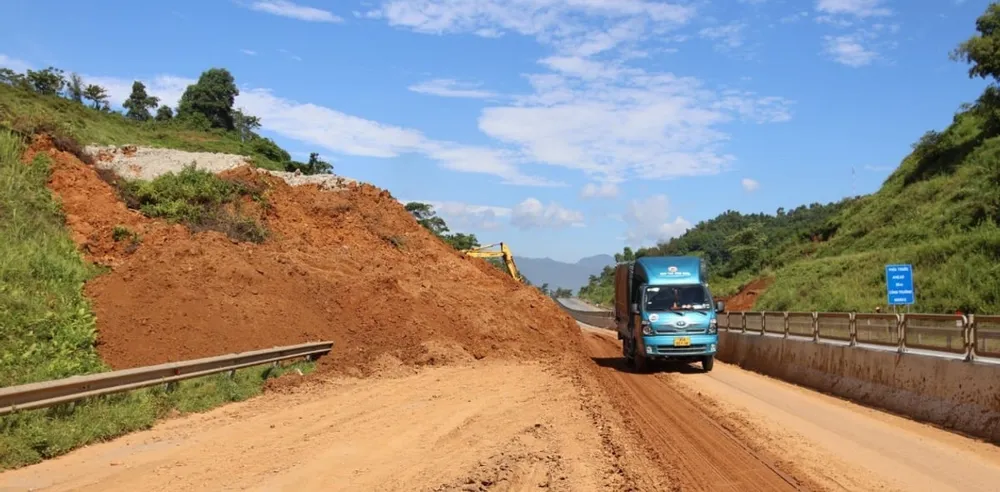
A large amount of rock and soil from the slope collapsed onto the road, completely cutting off the vital traffic route connecting the highland communes. Among the landslides were rocks weighing tens of tons. Fortunately, there were no vehicles passing through the area at the time of the landslide.

Chieng Lao commune authorities urgently mobilized forces and means to fix the problem. However, by the evening of the same day, the route was still paralyzed, and people and vehicles were advised to temporarily choose another route.
Due to the continued rain, the risk of further landslides is very high, especially on steep mountain passes and high mountains, requiring people to strictly comply with traffic regulations to ensure safety.
Previously, in Lao Cai province, a landslide also occurred at Km241+700 on the Noi Bai - Lao Cai expressway. Although this landslide was handled a week ago, on the afternoon of August 3, rocks and soil continued to slide down after heavy rain, obstructing traffic to Hanoi. The expressway operator has implemented a traffic diversion plan, diverting vehicles through National Highway 4E and then re-entering the expressway at IC17 (Xuan Giao intersection), while maintaining forces on duty at the scene to ensure safety.
The Department of Dyke Management and Natural Disaster Prevention ( Ministry of Agriculture and Environment ) and the meteorological agency warn that localities in the northern mountainous region need to review residential areas and high-risk areas on major roads and traffic routes in anticipation of increased landslides during the rainy season.
The National Center for Hydro-Meteorological Forecasting said that from the night of August 5 to August 6, heavy rain appeared over a wide area, especially in the northern mountainous provinces, ending a series of prolonged hot days.
According to data from the Vrain automatic rain gauge system up to 6:30 p.m. on August 6, localities with heavy rainfall include: Dien Bien (108.2mm), Lam Dong (98.6mm), Can Tho (94.4mm), Son La (93.6mm), Bac Ninh (92.2mm), Lai Chau (89.8mm), Hai Phong (89.2mm), Khanh Hoa (85mm), Hanoi (81mm), Lao Cai (77mm), Cao Bang (76.8mm), Thai Nguyen (63.8mm), Quang Ninh (63.6mm), Tuyen Quang (60.2mm), Lang Son (52.8mm).
In the North, the rain is forecast to last and continue from the night of August 6 to the afternoon of August 7, then gradually decrease from the evening of August 7. The South is also warned of the possibility of strong thunderstorms on the evening of August 6 and the afternoon and evening of August 7.
Source: https://www.sggp.org.vn/ca-tang-da-lon-do-ap-xuong-quoc-lo-279d-o-son-la-post807153.html








![[Photo] Discover the "wonder" under the sea of Gia Lai](https://vphoto.vietnam.vn/thumb/1200x675/vietnam/resource/IMAGE/2025/8/6/befd4a58bb1245419e86ebe353525f97)


![[Photo] Nghe An: Provincial Road 543D seriously eroded due to floods](https://vphoto.vietnam.vn/thumb/1200x675/vietnam/resource/IMAGE/2025/8/5/5759d3837c26428799f6d929fa274493)














Comment (0)