
Today, August 4, Hanoi and a series of provinces and cities in the North and Central regions continued to experience a day of scorching heat, hot and stuffy weather. Actual temperatures measured at 1 p.m. showed that the Hoa Binh (Phu Tho) and Lang (Hanoi) stations had the highest temperatures in the country.
Temperatures at 1 p.m. in the North (except Lai Chau, Dien Bien) and the area from Thanh Hoa to Da Nang, the eastern part of the provinces from Quang Ngai to Dak Lak, Khanh Hoa are generally 36-38°C, some places above 38°C. Some notable hot spots include Hoa Binh station (Phu Tho) 39.3°C; Lang station (Hanoi) 39.1°C; Phu Ly station (Ninh Binh) 38.2°C; Ha Tinh station 38.2°C; Viet Tri station (Phu Tho) 38.4; Lac Son station (Phu Tho) 38.3; Hoai Nhon station (Gia Lai) 38.9°C...
Some other stations in Hanoi also recorded temperatures at 1 p.m. exceeding 38°C: Son Tay 38.5°C; Hoai Duc 38.1°C.
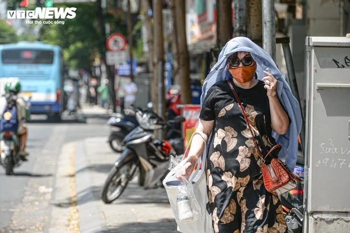
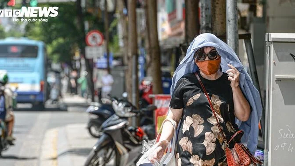
Today, August 4, Hanoi continues to be scorching hot. (Photo: Vien Minh)
The actual outdoor temperature that people feel can differ by 2-4°C from the actual measured temperature, or even higher if there are heat-absorbing surfaces such as concrete and asphalt.
The Meteorological Agency warns that heat can cause dehydration, exhaustion and heat stroke due to prolonged exposure to high temperatures. In addition, increased electricity demand, low humidity, and the risk of fires in residential areas and forest fires.
This evening and tonight, August 4, thunderstorms will appear in the North after days of intense sunshine. Accordingly, scattered showers and thunderstorms will occur in the mountainous and midland areas, with localized heavy rain, with rainfall of 10-30mm, and over 60mm in some places.
Tomorrow, August 5, the temperature in the North will decrease, heat waves will still occur in the Northern Delta and the South of Phu Tho province with the highest temperature of 35-36°C, some places over 36°C. From August 6, the heat waves in this area will gradually ease.
In the afternoon and night of August 5, rainfall tends to increase in the mountainous and midland areas of the North with moderate rain, heavy rain and thunderstorms, locally very heavy rain, rainfall ranging from 30-70mm, some places over 150mm. There is a risk of heavy rain, rainfall of about over 100mm in just 3 hours. Other places in the North will have moderate rain, locally heavy to very heavy rain, rainfall of 20-40mm, some places over 100mm.
From August 6 to the morning of August 7, the mountainous and midland areas of the North continued to experience moderate rain, heavy rain and thunderstorms, locally very heavy rain, with rainfall ranging from 30-60mm, with some places experiencing over 100mm. Other areas in the North experienced moderate rain, locally heavy rain with rainfall ranging from 10-30mm, with some places experiencing over 50mm.
Meanwhile, the heat and severe heat in the Central region is likely to last for many more days, making the weather more extreme.
In the evening and night of August 5, Thanh Hoa and Nghe An provinces are likely to experience scattered showers and thunderstorms, with locally heavy rain.
Thunderstorms after hours of intense heat and humidity pose a high risk of extreme weather events such as tornadoes, lightning, hail and strong gusts of wind.
Source vtcnews.vn
Source: https://baophutho.vn/ha-noi-va-phu-tho-nong-nhat-ca-nuoc-cao-nhat-xap-xi-40degc-237367.htm


Comment (0)