
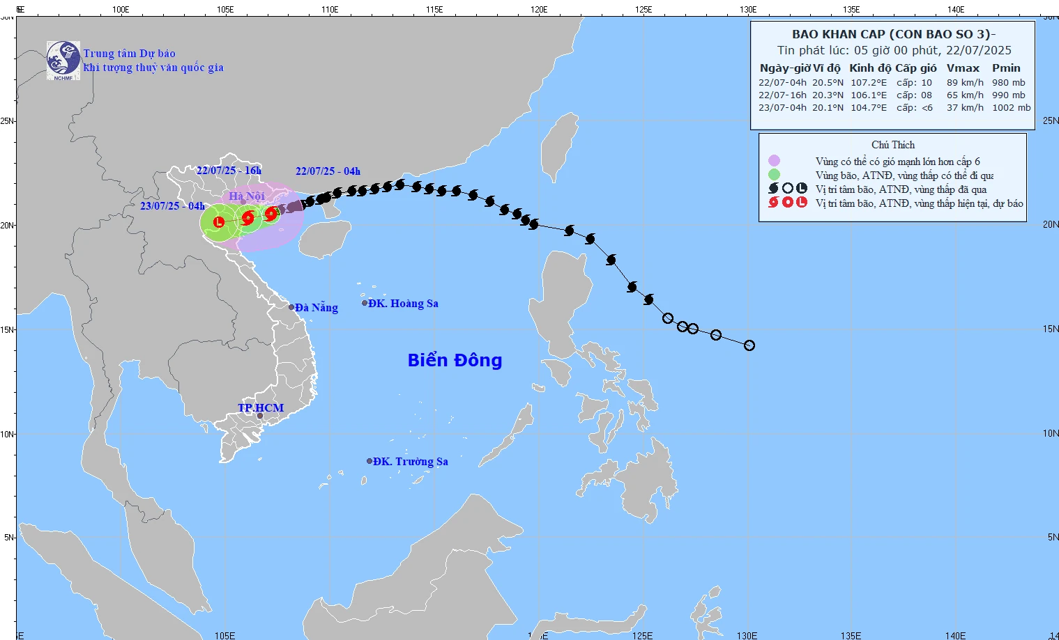
Forecast path of storm number 3.
According to the National Center for Hydro-Meteorological Forecasting's quick bulletin, at 6:00 a.m. this morning (July 21), the center of storm No. 3 was located at about 20.4 degrees North latitude; 106.9 degrees East longitude, about 170km southwest of Quang Ninh, about 60km southeast of Hai Phong, about 50km east of Hung Yen, and about 70km northeast of Ninh Binh. Strongest wind: Level 9-10 (89-102 km/h), gusting to level 13.
Due to the impact of storm No. 3, many coastal and inland areas have strong winds: Bach Long Vi level 10, gust level 12; Co To level 8, gust level 11; Cat Ba (Cat Hai special zone) level 6, gust level 8; Cua Ong level 9, gust level 12; Bai Chay level 8, gust level 9; Quang Ha level 8; Tien Yen level 7, gust level 9; Thai Binh level 7, gust level 8; Mong Cai level 6, gust level 9; Phu Lien level 6, gust level 8.
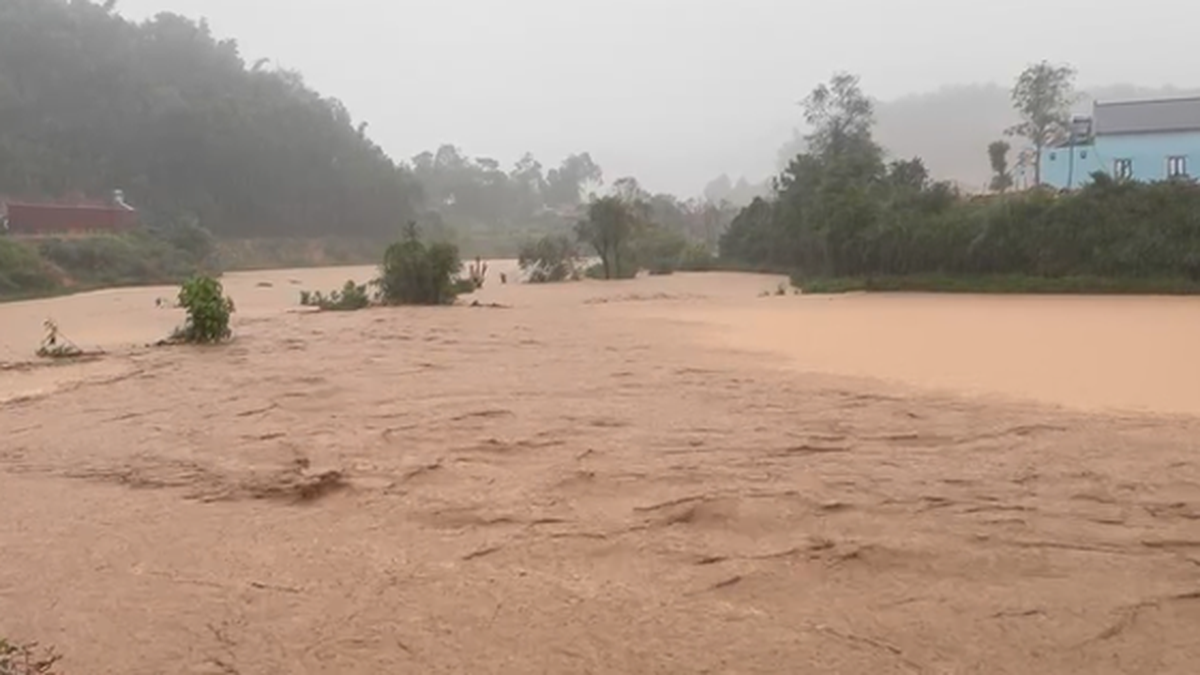
The Northern Delta and coastal areas, Thanh Hoa, Nghe An have moderate rain, heavy rain, some places have very heavy rain, common rainfall is 50-100mm, some places >130mm.
It is forecasted that by 4:00 p.m. on July 22, the storm center will make landfall in Hai Phong - Thanh Hoa with a level 8 intensity, gusting to level 10.
At 4:00 a.m. on July 23, the storm's center was over the Vietnam-Laos border area and weakened into a low pressure area.
Impact of storms
At sea, the North Gulf of Tonkin has winds of level 7-8, near the storm center level 9-10, gusting to level 13; waves 2-4m high, near the storm center 3-5m; very rough seas
Southern Bac Bo Gulf: wind level 6–7, near the storm center level 8, gust level 11; waves 2–4m high; rough seas
On land, from Quang Ninh to Nghe An provinces, there are winds of level 7-8, near the storm center of level 9-10, gusting to level 13.
Deep inland: Hai Phong, Hung Yen, Bac Ninh, Hanoi, Ninh Binh, Thanh Hoa wind level 6, gust level 7-8.
In addition, storms and rains may cause water levels to rise and flood coastal areas from Hung Yen to Quang Ninh. There is a high risk of flooding along the coast and river mouths at noon and afternoon on July 22.
Regarding rainfall, from early morning of July 22 to July 23, in the Northern Delta region, Thanh Hoa and Nghe An, there will be heavy to very heavy rain and thunderstorms with common rainfall of 200-300mm, locally over 500mm.
Other places in the Northern region and Ha Tinh have moderate rain, heavy rain, locally very heavy rain and thunderstorms with common rainfall of 70-150mm, locally over 250mm.
NDS
Source: https://baothanhhoa.vn/bao-cach-ninh-binh-70km-giat-cap-13-255650.htm


Comment (0)