
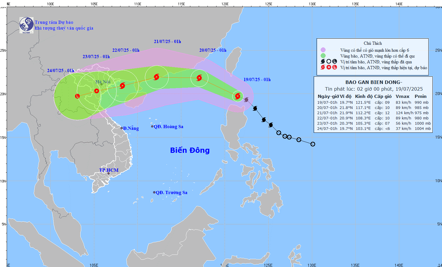
Forecasted path of storm Wipha at 2:00 a.m. on July 19, 2025. (Photo: nchmf)
According to the National Center for Hydro-Meteorological Forecasting, at 1:00 a.m. on July 19, Typhoon Wipha was at approximately 19.7 degrees North latitude - 121.5 degrees East longitude, in the sea north of Luzon Island (Philippines). The storm moved northwest at a speed of approximately 20 km/h; the strongest wind was level 9 (75-88 km/h), gusting to level 11.
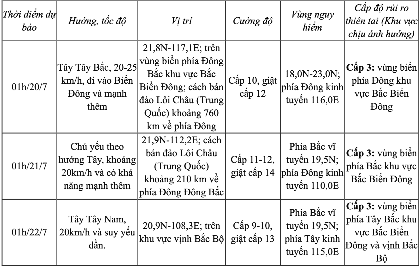
Forecast at about 1am tomorrow (July 20), the storm will enter the East Sea. The center of the storm is at 21.8 degrees North latitude - 117.1 degrees East longitude; in the northeastern sea area of the North East Sea; about 760km east of Leizhou Peninsula (China). Intensity level 10, gust level 12 and likely to strengthen.
At 1:00 a.m. on July 21, the storm was moving mainly westward at about 20 km/h, with its center about 210 km east-northeast of Leizhou Peninsula (China). The intensity was level 11-12, with gusts of level 14.
At around 1:00 a.m. on July 22, the storm moved in a West-Southwest direction, located at 20.9 degrees North latitude - 108.3 degrees East longitude, in the Gulf of Tonkin and gradually weakened.
Storm forecast (in the next 24 to 72 hours).
Warning from the next 72 to 120 hours, the storm will move mainly in the West Southwest direction, traveling 10-15km per hour, gradually weakening.
Due to the impact of the storm circulation, the eastern sea area of the North East Sea has winds gradually increasing to level 6-7, near the storm center level 8-10, gusting to level 12. Waves are 3-5m high. The sea is very rough. Ships in the danger zone are at high risk of being affected by whirlwinds, strong winds and big waves.
NDS
Source: https://baothanhhoa.vn/du-bao-sang-mai-20-7-bao-wipha-di-vao-bien-dong-tro-thanh-con-bao-so-3-255263.htm


Comment (0)