On the morning of July 19, the North experienced widespread heat. Many places such as Hanoi, Bac Giang , Tuyen Quang, Hung Yen, etc. had outdoor temperatures approaching or exceeding 37 degrees Celsius, making the weather sweltering. People had to find ways to combat the heat as temperatures rose.
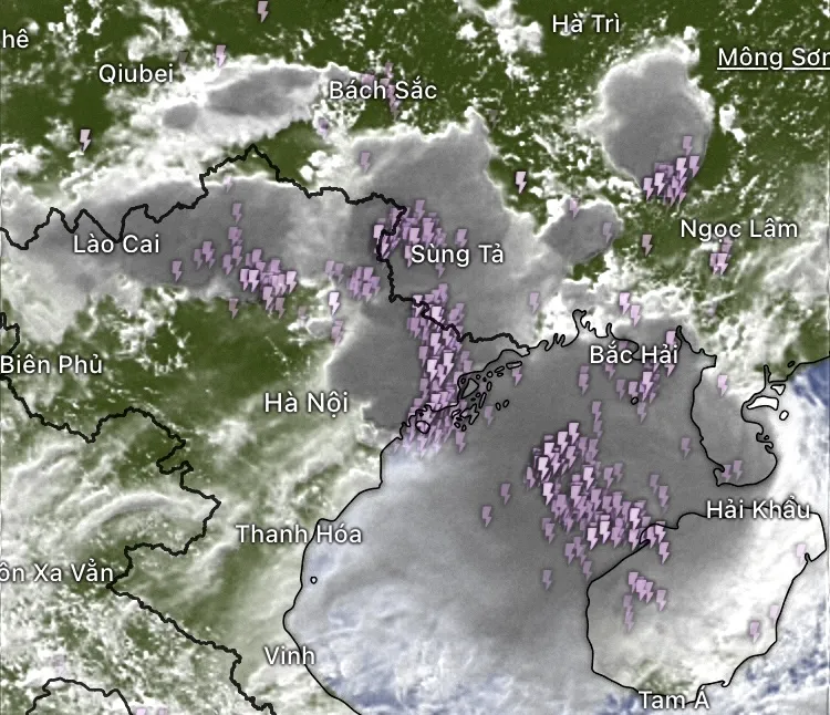
However, from around noon, a large band of thunderstorms began to form and quickly grew stronger, stretching from Lao Cai through Tuyen Quang to Cao Bang , Lang Son, spreading to Quang Ninh province and the Gulf of Tonkin. The thunderstorm appeared after the heat wave, causing howling winds and whirlwinds, making many people mistakenly think that Typhoon Wipha had arrived.
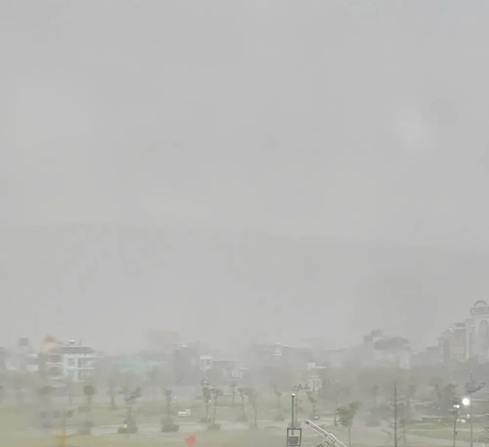
In the old Ha Long and Cam Pha areas (Quang Ninh province), at around 1:30 pm this afternoon, the weather turned to thunderstorms, followed by hail. In Ha Lam ward, small hailstones, larger than chopsticks, fell on the road and corrugated iron roof.

Some households had not yet closed their windows when the hail flew into their homes. This phenomenon lasted for about 10-15 minutes before the rain and wind stopped.
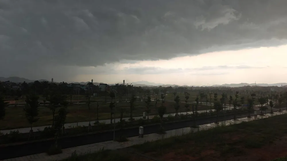
In Tuyen Quang province, dark clouds also gathered. Several inner-city roads were hit by trees falling due to strong winds, temporarily making traffic difficult. People shared that they were surprised by the rapid change in the weather, which in just a few hours had gone from scorching sunshine to torrential rain and wind.

In Hoa An commune (Cao Bang province), people also discovered hail. After a thunderstorm this afternoon, the center of Bao Lam commune (Cao Bang province) was slightly flooded in some low-lying areas. The rain came quickly and stopped quite suddenly.


According to meteorological experts, the storms and whirlwinds in the afternoon of July 19 in the North were caused by the atmospheric circulation of Typhoon Wipha (Typhoon No. 3) but were not yet direct impacts of the storm. This afternoon, the center of the storm was still in the Northeast of the East Sea. However, from now until the time the storm enters the Gulf of Tonkin, the outer circulation and the interaction between hot air and humid winds can cause extreme and dangerous weather phenomena.
On the afternoon of July 19, Mr. Hoang Phuc Lam, Deputy Director of the National Center for Hydro-Meteorological Forecasting, said that storm No. 3 is continuing to strengthen very quickly. In the next 24 to 36 hours, the storm is likely to reach level 12, gusting to level 15, causing waves 4-6m high and causing the North East Sea to be very rough.
Satellite images at 1:50 p.m. this afternoon (July 19) show that storm No. 3 has begun to form an eye - a sign that the storm's structure is completing and entering its strongest phase.
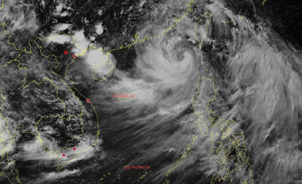
According to the meteorological agency, the storm's impact is forecast to be very wide when it makes landfall. Localities such as Quang Ninh, Hai Phong, Hung Yen, Ninh Binh and Thanh Hoa will be the areas most affected by the storm in the coming days.
The meteorological agency warned people in coastal areas to urgently monitor forecast information and proactively take measures to prevent storms and the risk of heavy rain, flash floods, and strong gusts of wind over a large area.
On the same day, July 19, the Ministry of Agriculture and Environment, Nguyen Hoang Hiep, signed an urgent dispatch, requesting localities to promptly respond to this storm.
Source: https://www.sggp.org.vn/mien-bac-bao-chua-vao-troi-da-toi-sam-dong-loc-va-mua-da-post804485.html
































Comment (0)