According to information from the Nghe An Province Hydrometeorological Station, currently, floods in the upper reaches of Nghe An rivers are continuing to rise; Muong Xen and Thach Giam stations have reached their peak but are still above alert level 3 (Thach Giam station is exceeding the historical flood level), at Con Cuong station the floods continue to rise and are exceeding the historical flood level. The downstream stations continue to rise but are below alert level 1.
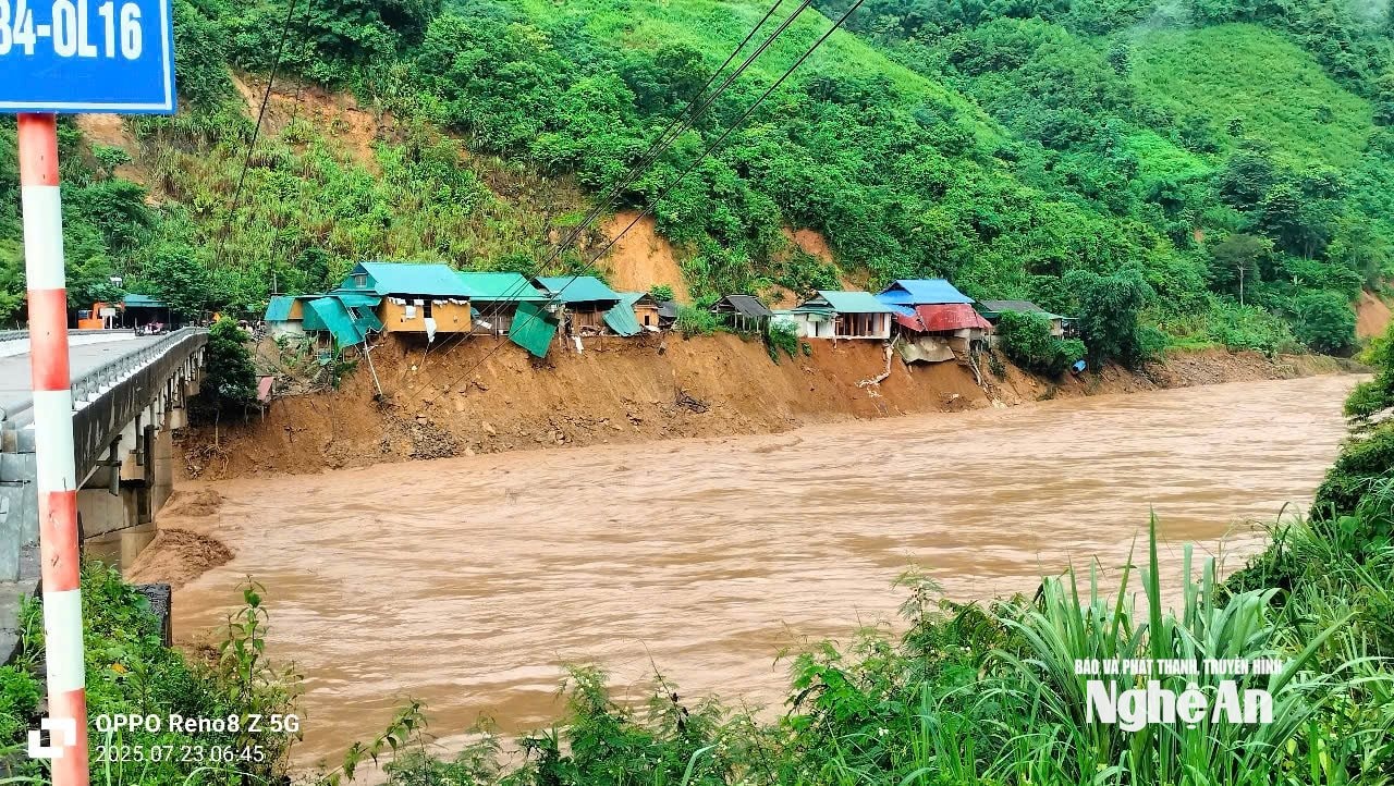
Water level at 1:00 p.m. on July 23, 2025 at some locations is as follows: At Muong Xen station, it is 14,285cm - 264cm lower than the historical water level; at Thach Giam, it is 7,516cm - 334cm higher than the historical flood level (historical flood level 7,182cm); at Con Cuong, it is 3,415cm - 161cm higher than the historical flood level (historical flood level 3,254cm); at Dua, it is 2,246cm - 4cm below alarm level 2; at Nam Dan station, it is 229cm - 311cm below alarm level 1.
Forecast for the next 6 hours: Floods on the Ca River continue to rise rapidly. Flood peaks on rivers are likely to exceed alert level 3. In particular, at Con Cuong station, water levels continue to rise and exceed historical flood levels (historical flood levels at Con Cuong are 3254cm, occurring on August 27, 1973).
Forecast for the next 6 - 24 hours: Floods on the upper reaches of the Ca River are likely to peak but will still fluctuate at a high level. Floods on the lower reaches of the Ca River will continue to rise.
Flood warning on the upper reaches of the Ca River continues to rise at a very high level. The flood peak on the upper reaches of the Ca River exceeds historical flood levels, while the downstream of Nghe An rivers is likely to exceed warning level 3 tomorrow evening. There is a very high risk of flash floods and landslides in mountainous areas and widespread flooding in low-lying areas along rivers and urban areas in Nghe An province.
Flood impact warning (if any): Floods on rivers and streams can cause flooding in low-lying areas along rivers, affecting water transport, aquaculture, agricultural production, people's lives and socio- economic activities.

To proactively respond to floods on rivers in Nghe An, the Standing Office of the Provincial Steering Committee for Natural Disaster Prevention, Search and Rescue and Civil Defense requests the People's Committees of communes and wards, Heads of provincial departments, branches and sectors, Directors of Irrigation LLCs and related units:
Notify authorities at all levels, people, organizations operating on rivers and riverbanks; aquaculture facilities on rivers, water transport vehicles; ferry terminals; production and business activities, sand and gravel exploitation to know information to proactively take preventive measures to ensure safety of people and property.
At the same time, review flood prevention plans to ensure safety for downstream areas, especially the dike system and residential areas on riverbanks to be ready to respond.
Direct information and communication agencies to increase the time and frequency of reporting on the media, especially the radio system in wards and communes about the rising flood on the Ca River; at the same time, coordinate with specialized agencies to guide flood prevention skills for people and related agencies and units to deploy response and minimize damage caused by rising river water.
Source: https://baonghean.vn/nghe-an-chi-dao-dam-bao-an-toan-ha-du-khi-lu-tren-thuong-nguon-cac-song-o-nghe-an-dang-len-cao-10303008.html



















Comment (0)