
Due to the impact of storm No. 3, on the night of July 23 and the morning of July 24, Lao Cai province experienced moderate rain, heavy rain, and very heavy rain in some places. The measured rainfall in some localities was as follows: Au Lau 155.4 mm; Thuong Bang La 101.4 mm; Chan Thinh 126.4 mm; Ban Lau 100mm... causing flooding and landslides in many places on national highways 4D, 2D, 32C and provincial roads 153, 154, 155, 156.
According to information from the Road Maintenance Management Board of Lao Cai province, heavy rains and floods have caused severe flooding at several locations on National Highway 32C (1 location at Km92+350), National Highway 2D (2 locations, Km95+200 at and Km95+400.
.")
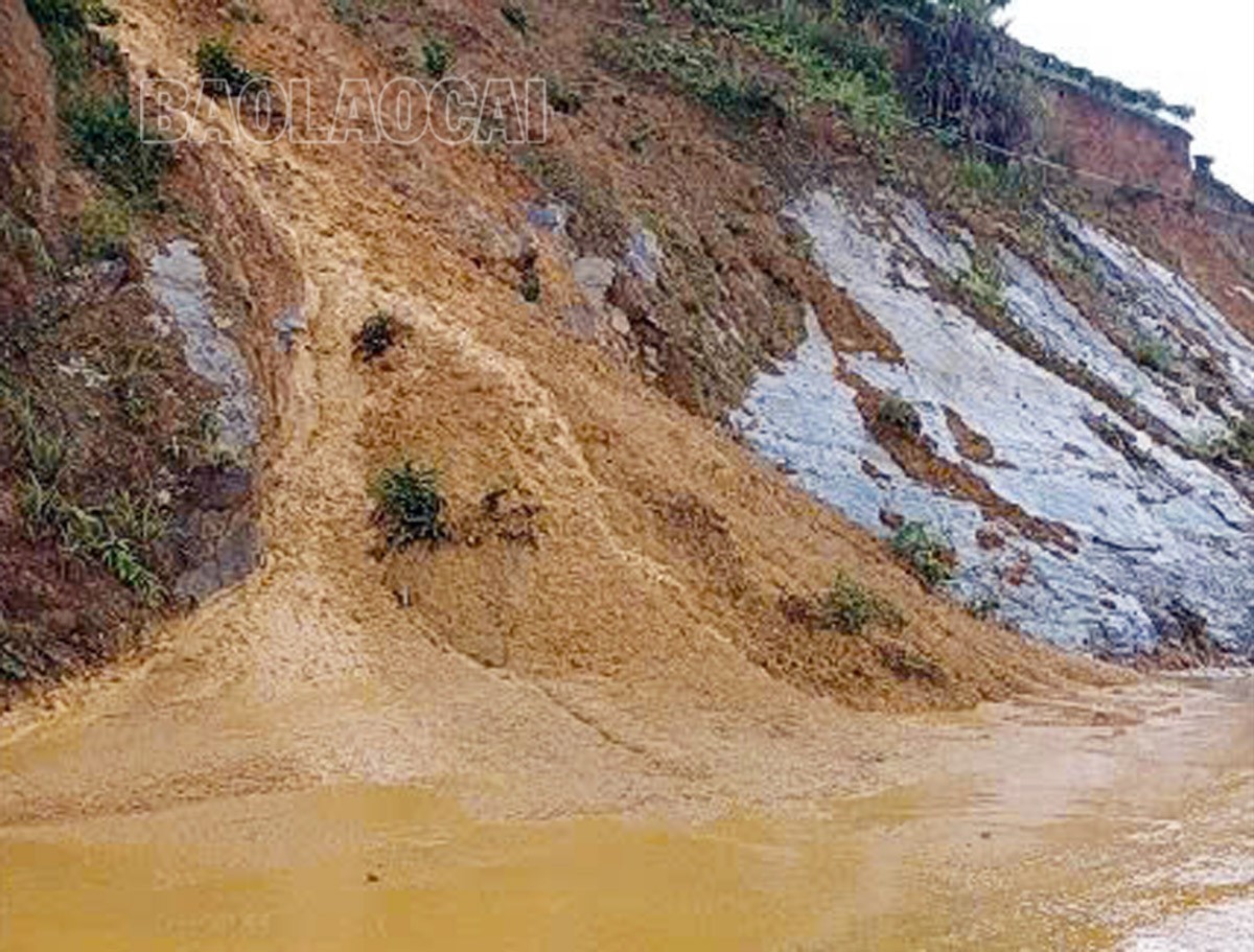
In addition, on National Highway 4D, there are 21 landslide locations, the road surface has sunk, and trees have fallen; provincial roads 153, 154, 155, 156, 156B, 157, 159... have landslides and flooding in 143 locations.
")
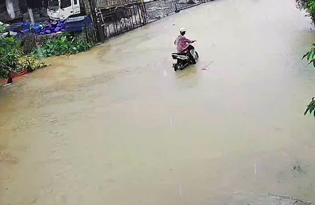
Among the flooded and landslide spots, there is a flooded spot at Km92+350, National Highway 32C (section through Au Lau ward); a landslide spot at Km163, National Highway 4D (section through Ban Lau commune) causing traffic congestion.

Immediately after the flooding, landslides, and fallen trees occurred, Lao Cai Road Maintenance Management Board stretched reflective tapes, put up warning signs to ensure traffic safety at dangerous locations; mobilized machinery and human resources to the scene to clear landslides, fallen trees, and ensure traffic safety for people's travel.
Warning, in the next 6 hours, the weather will continue to have moderate to heavy rain, causing the risk of flash floods on small rivers and streams in mountainous areas; landslides on national and provincial highways... Therefore, people need to be more vigilant and ensure safety when traveling on the roads.
Source: https://baolaocai.vn/mua-lu-gay-ngap-ung-sat-lo-nhieu-tuyen-quoc-lo-va-tinh-lo-tren-dia-ban-tinh-lao-cai-post649586.html


Comment (0)