
Strategic Connection
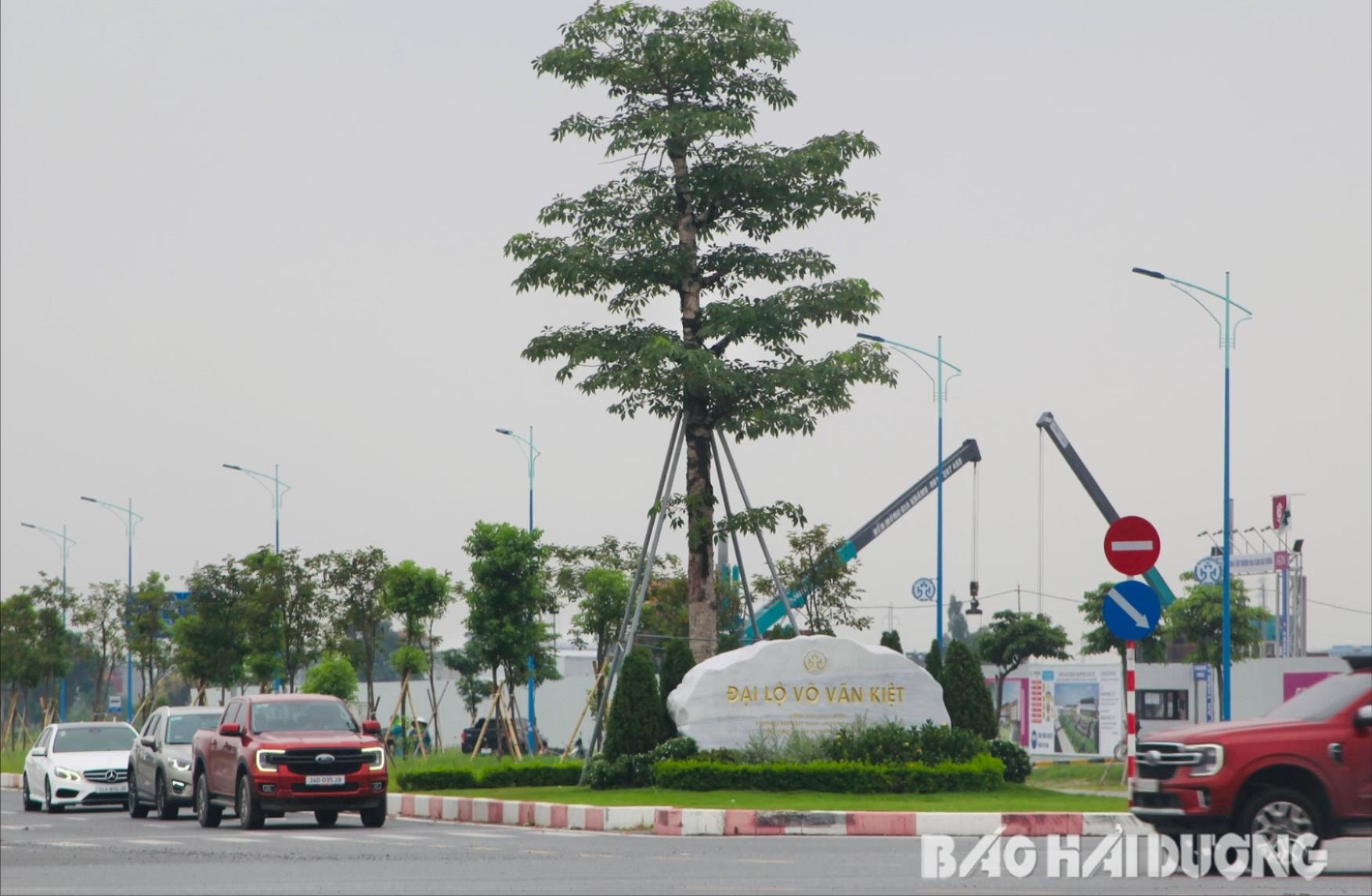
With the appearance of a modern traffic route, Vo Van Kiet Avenue ( Hai Duong City) impresses right from the starting point of the route with the prominent nameplate "Vo Van Kiet Avenue" carved on a large stone block located at the intersection with Vo Nguyen Giap Avenue.
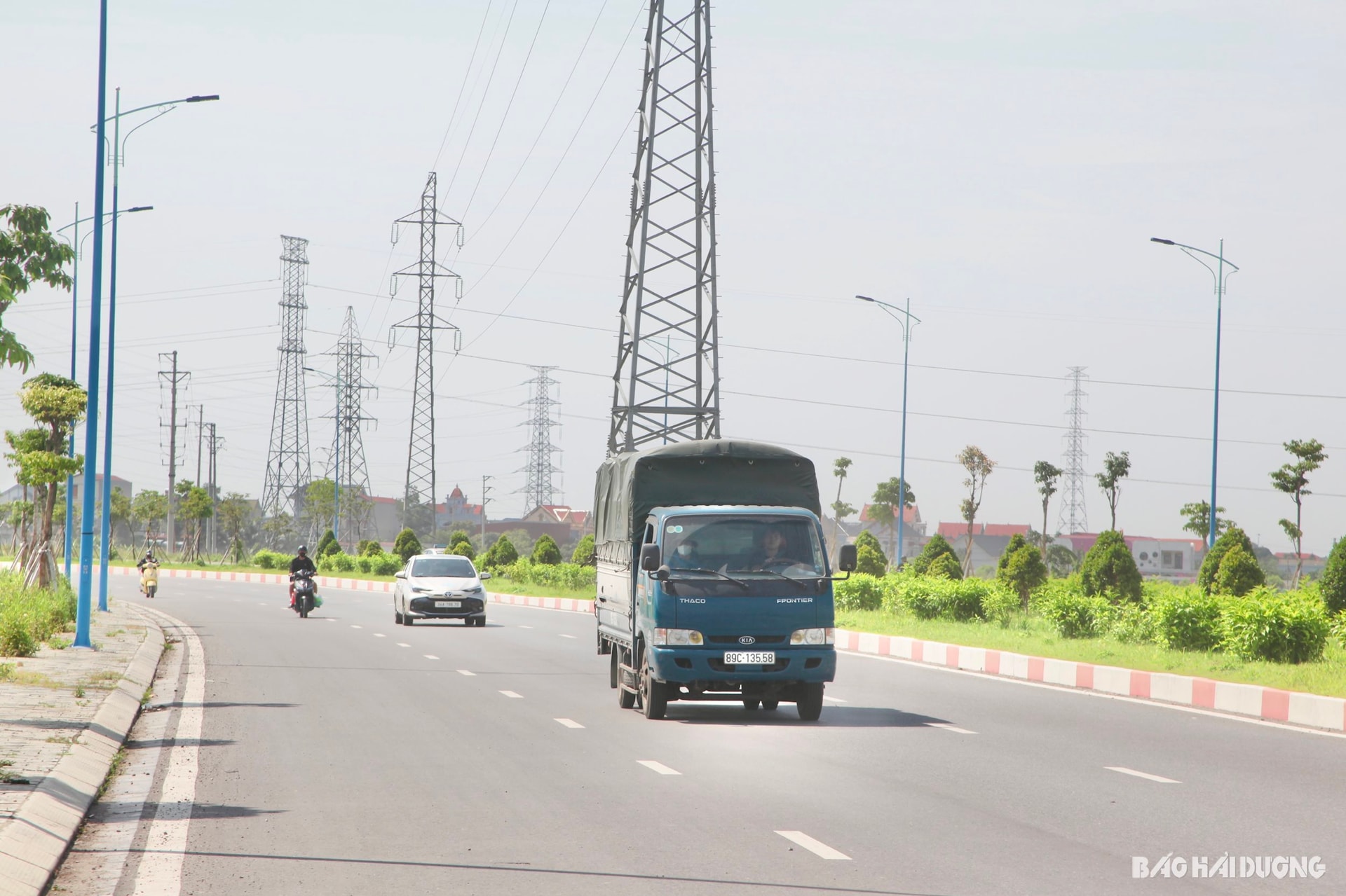
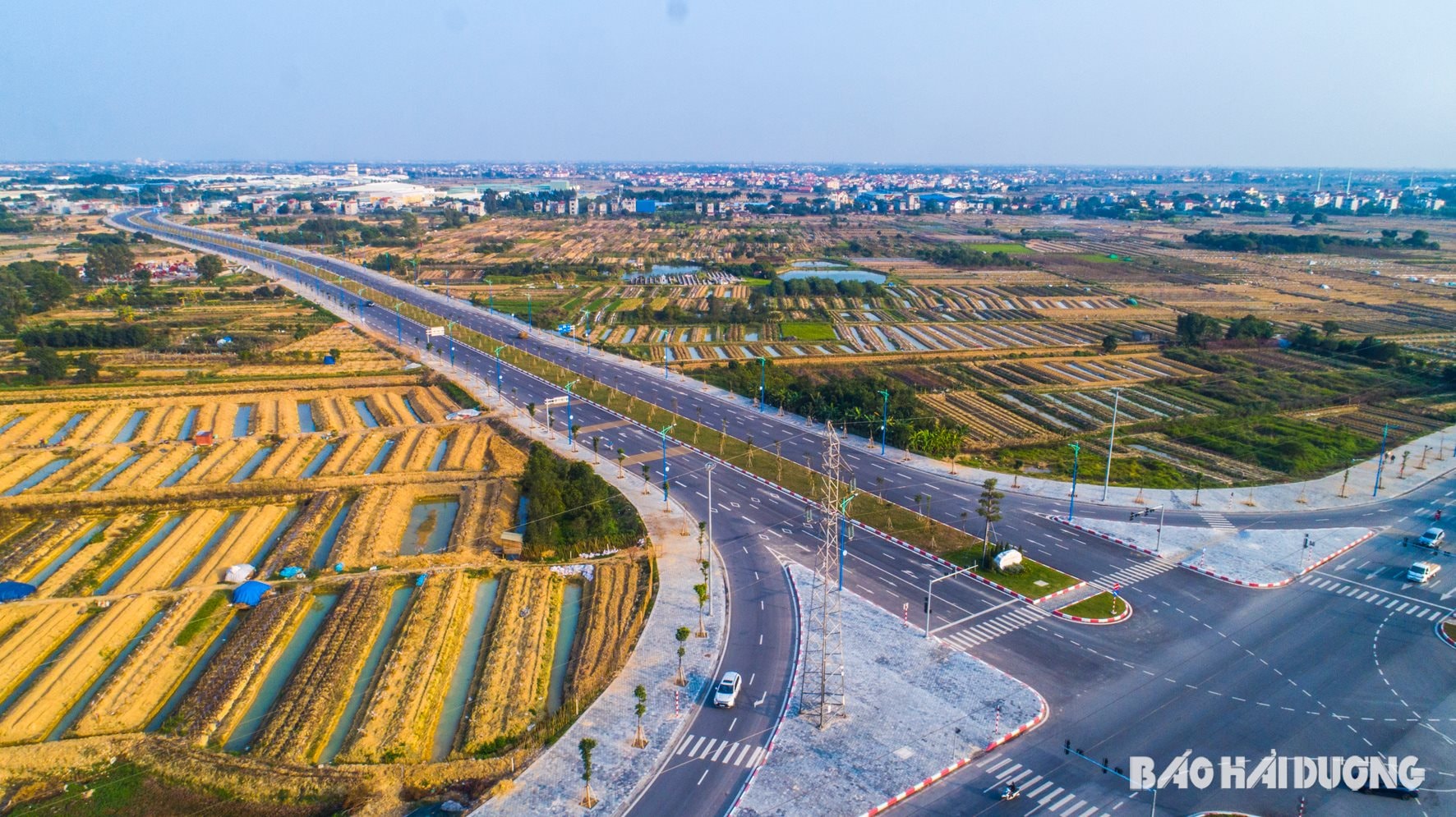
Vo Van Kiet Avenue is 5.67 km long, starting from the intersection with Vo Nguyen Giap Avenue, ending at Provincial Road 391. The road is 42 m wide, including 6 lanes. Both sides of the road are planted with trees, and the lighting system is synchronous. The route not only facilitates people's travel but also contributes to building a modern and civilized appearance and landscape architecture for Hai Duong City.
Vo Van Kiet Avenue is the first section of Hai Duong City's beltway I to be invested in, constructed and put into operation and use.
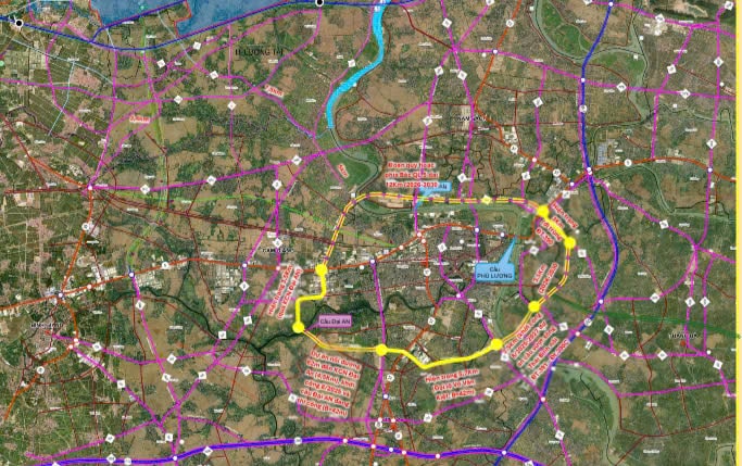
According to the Department of Construction, the Hai Duong City Beltway I has a total length of more than 30 km, passing through Hai Duong City and the districts of Nam Sach, Gia Loc, and Cam Giang.
Hai Duong City's Ring Road I starts from the intersection with Vo Nguyen Giap Avenue, then passes through the following points: intersection with National Highway 37 (in Thach Khoi Ward), Provincial Road 391 (Ngoc Son Commune), Provincial Road 390C (Tien Tien Commune) and Provincial Road 390 (Quyet Thang Commune). Next, the route runs in the same direction as Provincial Road 390 to Ben Han intersection (An Thuong Commune), then continues to intersect with Provincial Road 390D (also in An Thuong Commune).
From here, the route crosses the Thai Binh River, connecting Minh Tan Commune (Nam Sach District) with Duc Chinh Commune (Cam Giang District). The next section overlaps with a part of District Road 194B, intersects National Highway 5 in Tu Minh Ward, then goes through the main axis of Dai An Industrial Park. The route continues in the direction of Vu Cong Dan Street, turns left, crosses the Sat River and closes at the intersection with Vo Nguyen Giap Avenue.
According to the general planning of Hai Duong city, by 2030, the road is determined to be built with a minimum scale meeting the standards of a grade II road, with a roadbed width of 42 m.
The Hai Duong City Ring Road I project, once completed, will form a belt surrounding the city, reducing pressure on the central routes of Hai Duong City, connecting with key traffic routes such as National Highway 5, National Highway 37 and many provincial roads...
During this period of provincial-city merger, the first beltway continues to have the meaning of direct connection with Hai Phong City when the two localities propose an investment plan for a traffic route about 23.5 km long, connecting from the first beltway of Hai Duong City to the intersection of National Highway 10 with Nguyen Truong To Street, An Duong District ( Hai Phong City).
Spatial development axis
Currently, Hai Duong City's Beltway I has Vo Van Kiet Street, over 5.67 km long, over 3 km of Beltway I running on Provincial Road 390 and 3.5 km running through Dai An Industrial Park, which are being exploited and used. Some projects are being invested in and constructed. That is the Hai Duong City Beltway I Construction Project, from Vo Nguyen Giap Avenue to Dai An Industrial Park Extension, with a length of 3.5 km and a width of 32.5 - 42 m. The starting point of the route intersects with Vo Nguyen Giap Avenue in Lien Hong Commune (Hai Duong City), the end point is adjacent to Kim Son River overpass in Thong Nhat Commune (Gia Loc).
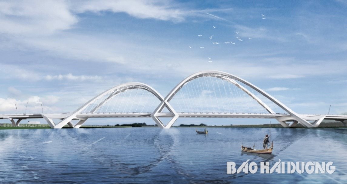
The project to build a bridge over the Thai Binh River and access roads on the Hai Duong City Ring Road I section from Provincial Road 391 to Road 390C includes the construction of a bridge over the Thai Binh River approximately 663 m long and 22.5 m wide. The road section from Provincial Road 391 to the Thai Binh River bridge is approximately 0.437 km long. The section from the Thai Binh River bridge to Provincial Road 390C is 1.4 km long.
The two projects are expected to start construction in the third quarter of 2025.
Along with that, the Dai An bridge project connecting Gia Loc and Cam Giang districts has a bridge length and approach road of about 265 m, width of 25 m. The starting point of the project connects the road section, within the scope of the Hai Duong City Ring Road I Construction Project, from Vo Nguyen Giap Street to the Dai An Industrial Park Expansion; the end point connects the boundary of the Dai An Industrial Park Expansion Project (Phase II). The project proposed by Dai An Joint Stock Company for funding is also under construction.
The remaining sections of Ring Road I will be invested in and constructed in the 2026 - 2030 period.
Beltway I intersects with many national highways and provincial roads, forming a belt surrounding Hai Duong City, connecting industrial parks and important functional areas of Hai Duong City. At the same time, it connects inter-regionally with Gia Loc, Cam Giang, Nam Sach, Thanh Ha, Tu Ky districts, facilitating the promotion of socio-economic development in Hai Duong City and the province.
With many advantages in location and traffic, the southern area of Hai Duong city with the first beltway passing through will have great potential for exploitation, forming green urban areas, service centers, ecological parks, and high-rise highlights in the future.
NINH THANHSource: https://baohaiduong.vn/duong-vanh-dai-i-tp-hai-duong-ket-noi-lien-vung-mo-rong-khong-gian-phat-trien-414271.html


Comment (0)